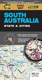
|
South Australia State & Cities Map 519 10th waterproof
Sheet map, folded
Main Details
| Title |
South Australia State & Cities Map 519 10th waterproof
|
| Authors and Contributors |
By (author) UBD Gregory's
|
| Series | State Map |
|---|
| Physical Properties |
| Format:Sheet map, folded | | Pages:1 | | Dimensions(mm): Height 920,Width 690 |
|
| ISBN/Barcode |
9780731932955
|
| Audience | |
|---|
| Edition |
Tenth Edition
|
| Illustrations |
Full colour
|
|
Publishing Details |
| Publisher |
UBD Gregory's
|
| Imprint |
UBD Gregory's
|
| Publication Date |
11 November 2021 |
| Publication Country |
Australia
|
Description
The latest edition of the South Australia State and Cities map is an essential tool when travelling in South Australia. It includes a state map and index to towns and localities at a scale of 1 : 1 900 000 and state touring information. In addition to this, there is a map covering 150km around Adelaide including the Yorke & Fleurieu Peninsulas and Kangaroo Island at a scale of 1 : 100 000 and street level mapping for Adelaide City and Coober Pedy, Hahndorf, Kangaroo Island, Murray Bridge, Nuriootpa, Renmark and Victor Harbor.
|