|
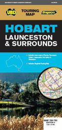
Hobart Launceston & Surrounds Map 780/781 4th ed
Sheet map, folded
Main Details
| Title |
Hobart Launceston & Surrounds Map 780/781 4th ed
|
| Authors and Contributors |
By (author) UBD Gregory's
|
| Series | Touring Map |
|---|
| Physical Properties |
| Format:Sheet map, folded | | Pages:1 | | Dimensions(mm): Height 690,Width 1000 |
|
| ISBN/Barcode |
9780731932245
|
| Audience | |
|---|
| Edition |
Fourth Edition
|
| Illustrations |
Full colour
|
|
Publishing Details |
| Publisher |
Universal Publishers
|
| Imprint |
UBD Gregory's
|
| Publication Date |
15 October 2019 |
| Publication Country |
Australia
|
Description
The latest edition of the Hobart Launceston & South East Tasmania Map has been fully revised and updated and includes: A regional touring map covering Burnie, Ulverstone, Devonport, in the north, South East Cape in the south, Swansea in the east and Cradle Mountain Lake St Clair in the west. Maps and street indexes for Hobart and Launceston and town maps of Burnie, Devonport, Port Arthur and Ulverstone. City Centre maps of Hobart and Launceston. A list of regional touring attractions. With all this information packed into one handy fold out map it is an essential tool for both the tourist and local alike.
|