|
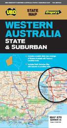
Western Australia State & Suburban Map 670 16th ed
Sheet map, folded
Main Details
| Title |
Western Australia State & Suburban Map 670 16th ed
|
| Authors and Contributors |
By (author) UBD Gregory's
|
| Series | State Map |
|---|
| Physical Properties |
| Format:Sheet map, folded | | Pages:1 | | Dimensions(mm): Height 920,Width 690 |
|
| ISBN/Barcode |
9780731932061
|
| Audience | |
|---|
| Edition |
Sixteenth Edition
|
| Illustrations |
Full colour
|
|
Publishing Details |
| Publisher |
Universal Publishers
|
| Imprint |
UBD Gregory's
|
| Publication Date |
1 March 2019 |
| Publication Country |
Australia
|
Description
The latest edition of the Western Australia State and Suburban map has been fully revised and updated and includes: Suburban map coverage of Perth and surrounds, north to Ridgewood, south to Halls Head and North Dandalup, and east to the Lakes, Karragullen and Gleneagle (including insets of Yanchep and Pinjarra) with an index to the suburbs and localities included on this map . State map and index to towns, localities and homesteads with a section on South West Western Australia at a scale of 1: 870 000. With the quality and clarity you have come to expect from a UBD Gregorys map this is an essential tool for navigating your way around Western Australia, Perth, Rockingham and Mandurah.
|