|
Newcastle Suburban Streets Map 280 19th ed
Sheet map, folded
Main Details
| Title |
Newcastle Suburban Streets Map 280 19th ed
|
| Authors and Contributors |
By (author) UBD Gregory's
|
| Series | City Map |
|---|
| Physical Properties |
| Format:Sheet map, folded | | Dimensions(mm): Height 1000,Width 690 |
|
| ISBN/Barcode |
9780731931927
|
| Classifications | Dewey:912.42876 |
|---|
| Audience | |
|---|
| Edition |
Nineteenth Edition
|
|
Publishing Details |
| Publisher |
Universal Publishers
|
| Imprint |
UBD Gregory's
|
| NZ Release Date |
18 April 2023 |
| Publication Country |
Australia
|
Description
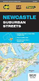
The latest edition of the popular Newcastle Suburban Streets has been fully revised and updated. One side features a regional touring map which covers the Hunter Valley and surrounding region at a scale of 1: 450 000 from Ardglen in the north to Lower Portland in the south and Merriwa in the west and along the coast from North Haven in the north to Bateau Bay in the south plus an index to the towns noted on this map. On the other side there is street level mapping and index to the suburbs & streets for Newcastle and Lake Macquarie at a scale of 1 : 25 000 with coverage from Sandgate in the north, Wangi Wangi in the south and West Wallsend in the west and along the coast from Stockton in the north to Blacksmiths in the west. With so much information contained in this handy fold out map this is an essential to to have on hand when travelling around Newcastle.
|