|
Medieval Roads and Tracks
Paperback / softback
Main Details
| Title |
Medieval Roads and Tracks
|
| Authors and Contributors |
By (author) Paul Hindle
|
| Series | Shire Archaeology |
|---|
| Physical Properties |
| Format:Paperback / softback | | Pages:64 | | Dimensions(mm): Height 210,Width 149 |
|
| Category/Genre | Medieval European archaeology |
|---|
| ISBN/Barcode |
9780747803904
|
| Classifications | Dewey:388.10902 |
|---|
| Audience | |
|---|
|
Publishing Details |
| Publisher |
Bloomsbury Publishing PLC
|
| Imprint |
Shire Publications
|
| Publication Date |
31 July 2008 |
| Publication Country |
United Kingdom
|
Description
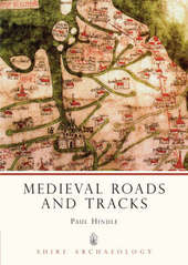
The medieval economy was centred on a phenomenal growth in trade of all kinds of goods, yet few have studied the actual network of roads that was so vital to medieval trading. Starting with the basic concept of a 'road' in medieval times, and discussing the increasing need to travel, this book explores the evidence from documents and maps that provide clues as to where the roads of medieval Britain led, connecting the study of individual roads together to paint an image of the broader road network. The author also uses findings from archaeological surveys and bird's-eye-view photographs to trace the centuries-old routes and illustrate the winding tracks that once carried goods to market.
Author Biography
Dr Paul Hindle took early retirement in 2000; he was previously a Senior Lecturer in Geography. He is Honorary Secretary of Manchester Geographical Society. His recent books include Roads and Tracks of the Lake District (Cicerone Press, 1998) Maps for Historians (Phillimore, 1998) Roads and Tracks for Historians (Phillimore, 2001). He is also the author of Medieval Town Plans in the Shire Archaeology series.
Reviews"Author Paul Hindle presents a straightforward dissertation on the network of roads and paths throughout medieval England... In determining where the medieval roads led, Hindle becomes a sort of cartographic sleuth, turning to a number of resources available to the modern scholar... The book is illustrated throughout with photographs, both aerial and ground level, as well as an assortment of graphs and maps...it successfully brings to light its chosen subject." --Barb Allshouse, Renaissance Magazine (August 2009)
|