|
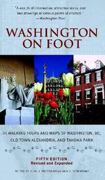
Washington on Foot, Fifth Edition: 24 Walking Tours and Maps of Washington, DC, Old Town Alexandria, and Takoma Park
Paperback / softback
Main Details
| Title |
Washington on Foot, Fifth Edition: 24 Walking Tours and Maps of Washington, DC, Old Town Alexandria, and Takoma Park
|
| Authors and Contributors |
Edited by John J. Protopappas
|
|
Edited by Judith Meany
|
| Physical Properties |
| Format:Paperback / softback | | Pages:240 | | Dimensions(mm): Height 229,Width 134 |
|
| Category/Genre | Travel and holiday guides |
|---|
| ISBN/Barcode |
9781588343208
|
| Classifications | Dewey:917.530442 |
|---|
| Audience | |
|---|
| Illustrations |
75 B&W ILLUSTRATIONS 26 MAPS
|
|
Publishing Details |
| Publisher |
Smithsonian Books
|
| Imprint |
Smithsonian Books
|
| Publication Date |
27 March 2012 |
| Publication Country |
United States
|
Description
The best way to see-really see-any city is on foot. The perennial favorite Washington on Foot has been completely revised and updated to offer 24 walking tours of Washington's neighborhoods. Familiar monuments and museums are all here, side-by-side with lesser-known historic sites and storied residential neighborhoods. Washington on Foot offers history, culture, architecture, urban planning, and more. It's the complete city in a tidy package and the only "outdoor" Washington guidebook needed. Ideal not only for visitors but for locals who truly want to get to know their city. The updated fifth edition of this essential guide features user-friendly maps, architectural illustrations, historical and culture information, and much more.
Author Biography
John J. Protopappas is a developer who lectures widely on land-use related topics. Judith Meany, Ph.D., FAICP is Professor of Practice in the School of Architecture and Planning at The Catholic University of America where she created and directs the M.ARCH with a Real Estate Development Concentration.
Reviews"A delightful 'must' for anyone wanting to explore the nation's capital."-Washington Times "This guidebook is one of the best."-Washingtonian "Excellent maps."-New York Times "A wealth of information, attractive maps, and line drawings of various points of interest."-Washington Post
|