|
Denmark
Sheet map, folded
Main Details
| Title |
Denmark
|
| Authors and Contributors |
By (author) National Geographic
|
| Physical Properties |
| Format:Sheet map, folded | | Pages:1 | | Dimensions(mm): Height 235,Width 110 |
|
| Category/Genre | Travel and holiday guides
Travel maps and atlases |
|---|
| ISBN/Barcode |
9781566957601
|
| Audience | |
|---|
|
Publishing Details |
| Publisher |
National Geographic Maps
|
| Imprint |
National Geographic Maps
|
| Publication Date |
5 July 2018 |
| Publication Country |
United States
|
Description
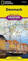
Waterproof, Tear-Resistant, Travel Map Explore Denmark's more than 100 islands, the largest of which are connected by a series of long bridges and tunnels with National Geographic's Denmark Adventure Map. Designed to meet the needs of adventure travellers with its detailed, accurate information, this map includes the location of cities and towns with a user-friendly index and a clearly marked road network complete with distances and designations for motorways, major routes, and roads. In addition, side roads and tracks are shown for those seeking to explore off the beaten path. Hundreds of points of interest that highlight the diverse, unique, and exotic destinations within the country such as national parks and reserves, wildlife parks, World Heritage sites, and archeological sites. Important travel aids like airports, airfields, railroads, ferry routes, and lighthouses are included as well. The front of the map shows the northern half of the Jutland peninsula and North Jutlandic Island which only became an island after a storm in the 1800s. The reverse side of the map shows the southern half of the country, includes the large interconnected islands of Fyn, Zealand, and Falster as well as many smaller islands. Whatever your destination, this expertly crafted map will help you make the most of your trip and is a perfect companion to a guidebook. Every Adventure Map is printed on durable synthetic paper, making them waterproof, tear-resistant and tough - capable of withstanding the rigours of international travel. Scale: 1: 320,000
Author Biography
Founded in 1915 as the Cartographic Group, the first division of National Geographic, National Geographic Maps has been responsible for illustrating the world around us through the art and science of mapmaking.Today, National Geographic Maps continues this mission by creating the world's best wall maps, recreation maps, atlases, and globes which inspire people to care about and explore their world.
|