|
Collins Pictorial Maps: Tartans Map of Scotland
Sheet map, folded
Main Details
| Title |
Collins Pictorial Maps: Tartans Map of Scotland
|
| Authors and Contributors |
By (author) Collins Maps
|
| Series | Collins Pictorial Maps |
|---|
| Physical Properties |
| Format:Sheet map, folded | | Dimensions(mm): Height 257,Width 124 |
|
| Category/Genre | Genealogy, heraldry, names and honours |
|---|
| ISBN/Barcode |
9780007485888
|
| Classifications | Dewey:929.209411 |
|---|
| Audience | |
|---|
| Edition |
New edition
|
| Illustrations |
140 col illus, Index
|
|
Publishing Details |
| Publisher |
HarperCollins Publishers
|
| Imprint |
Collins
|
| Publication Date |
5 July 2012 |
| Publication Country |
United Kingdom
|
Description
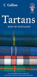
The Tartans Map of Scotland illustrates Scotland's clans, tartans and family names and is officially approved by the Scottish Tartans Authority. This beautifully illustrated map is both decorative and informative. The map includes: * 247 tartans with clan/family names, alphabetically arranged for easy look-up, from Abercromby to Young. * Territories map of principal clans at the beginning of the 17th century. * Historical background to clans and tartans. * Internet links for more information. The most distinctive feature of Scotland's history is arguably that of the clan. Highland dress and the tartan is a powerful symbol of the wearer's pride in their Scottish ancestry and in Scotland itself. Also available as a wall map (ISBN 978-0-00-748589-5). Other titles in the series include: Castles Map of Scotland Whisky Map of Scotland Scotland of Old Clans Map
Author Biography
Explore the world through accurate and up-to-date mapping.
|