|
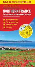
Northern France Marco Polo Map
Sheet map, folded
Main Details
| Title |
Northern France Marco Polo Map
|
| Authors and Contributors |
By (author) Marco Polo Travel Publilshing
|
| Series | Marco Polo Maps |
|---|
| Physical Properties |
| Format:Sheet map, folded | | Pages:1 | | Dimensions(mm): Height 248,Width 127 |
|
| ISBN/Barcode |
9783829767637
|
| Classifications | Dewey:912.4427 |
|---|
| Audience | |
|---|
|
Publishing Details |
| Publisher |
MAIRDUMONT GmbH & Co. KG
|
| Imprint |
MAIRDUMONT GmbH & Co. KG
|
| Publication Date |
2 April 2012 |
| Publication Country |
Germany
|
Description
Fully updated for 2018... Marco Polo maps feature completely up-to-date, digitally generated mapping. The high quality cartography with distance indicators and scale converters aid route planning. Includes 6 city maps: Amiens, Chartres, Lille, Orleans, Paris, Rouen. Major sights and key points of interest are marked on the map by numbered stars and these are listed in the index booklet with a brief description to help travellers pick the best places to see en route. Comprehensive index. The map scale is 1 : 300 000.
Author Biography
Marco Polo Travel Publishing offers a wide range of high quality cartographic products and travel guides. Marco Polo Pocket Guides are known for their handy, compact format and Insider Tips. Our Travel Handbooks are the first to include infographics and our Spiral Guides feature unique lay-flat spiral binding. Marco Polo Maps are famous for the high quality of cartography in their Country, City and Holiday Maps.
|